Your trip map can be dressed up to answer whatever question you have, from "what does this valley look like" to "how far is that turnoff, really".
Changing the base map
Switch the map between Map, Satellite, and Terrain. Terrain is handy for reading the lay of the land before a mountain grade; satellite helps you eyeball a campground before you commit.
The campgrounds control
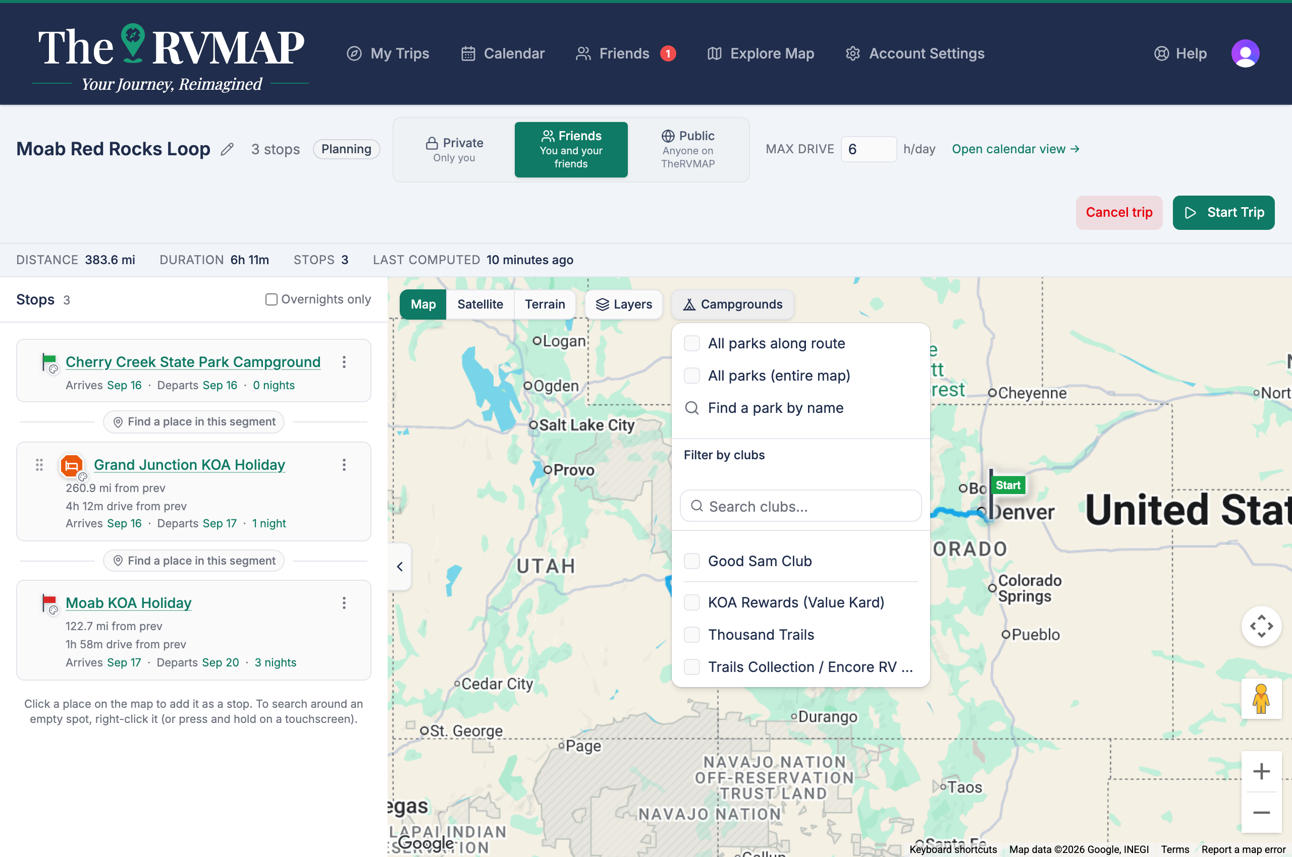
Open the campgrounds control to choose what parks to show:
- All parks along route shows parks near the road you are travelling.
- All parks (entire map) shows every park in view. These two are mutually exclusive, so you pick one or the other.
- Find a park by name looks up a specific park.
- Filter by clubs narrows whichever park layer is showing to the clubs you belong to.
The two measuring tools
There are two ways to measure, and they answer different questions:
- Measure distance along route follows the road, for "how far is it to drive there".
- Measure distance in any direction draws a straight line, for "how far is that as the crow flies".
In the app
On the phone, all of this gathers into a single Layers and tools sheet reached from the trip's toolbar.
Related
- Finding campgrounds and places along your route
- Weather and traffic on your trip map
- Where the planner suggests you sleep, and how to pick the park
Was this article helpful?
That’s Great!
Thank you for your feedback
Sorry! We couldn't be helpful
Thank you for your feedback
Feedback sent
We appreciate your effort and will try to fix the article